Presque Isle River
Presque Isle River
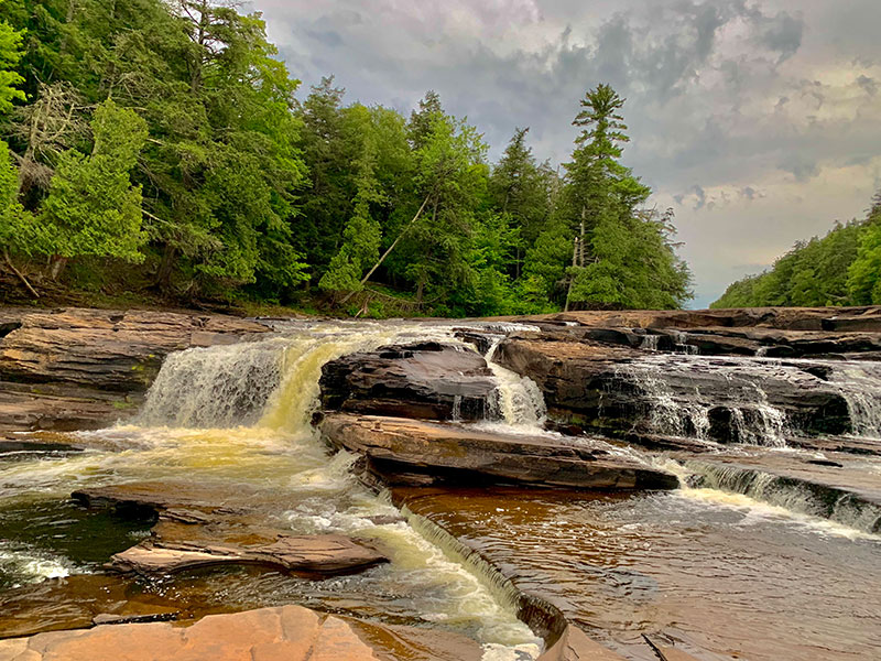
The Presque Isle is the largest river in the Porcupine Mountains where it drains out into Lake Superior. The East and West River Trails does a loop around a portion of the river. The entire loop is a little under 3 miles and takes you to Lake Superior and three waterfalls, Nawadaha Falls, Manido Falls, Manabezho Falls.
We spent 3 days trying to explore as much as we could at Porcupine Mountains Wilderness Sate Park. Our days were filled with so much to see and do. We had already visited Lake of the Clouds, Bond Falls and Agate Falls.
On our last night, we wanted to go on one more hike because in the morning we were packing up camp to go further up North to Fort Wilkins State Park. After dinner we headed out to Presque Isle River. It ended up being one my favorite hikes. In hindsight, I would have left more time to explore this scenic area.
It was about a half hour drive from Union Bay campground. We packed some flashlights as we knew it was a race against sunlight.
We parked near the ranger station. Our tail head was near the center of the loop on the West River Trail. Our hike began through mostly forested areas and open grassy areas. Once we reached the river, we followed a boardwalk where we had amazing views of the rapids and waterfalls.
The More You Know:
The hike was fairly easy. The board walk had multiple levels so anticipate quite a few stairs. The peninsula across the suspended bridge had trees roots and very uneven grounds. Please keep in mind, there are bears in this area and always be aware of your surroundings when hiking in the UP.
Maps
Here are some helpful maps that will make planing for your trip easier.
Porcupine Mountains State Park – Hiking Map
Porcupine Mountains State Park – Waterfall Map
Porcupine Mountains State Park – Backcountry Campsites & Bear Poles
East-West River Trails – Hiking Map